GPSMAP 1223 Non-sonar with Worldwide Basemap
- List of product variants
| Sort by Price | Sort by Availability | Sort by CODE | Sort by Display size, inch | Sort by Sonar |
|---|---|---|---|---|

1,390.96 €
1,495.66 €
|
In stock
|
5602719
|
Display size, inch:
|
Sonar:
|

2,533.91 €
2,724.63 €
|
Out of stock
|
5602721
|
Display size, inch:
|
Sonar:
|

978.89 €
1,052.57 €
|
In stock
|
5602717
|
Display size, inch:
|
Sonar:
|

815.61 €
877.00 €
|
Out of stock
|
5602716
|
Display size, inch:
|
Sonar:
|

1,227.68 €
1,320.09 €
|
Out of stock
|
5602718
|
Display size, inch:
|
Sonar:
|

2,370.63 €
2,549.06 €
|
Out of stock
|
5602720
|
Display size, inch:
|
Sonar:
|
The price provided is NET-price, meaning shipment and VAT are not included. Additional duties and tax payments might be required. Taxes and delivery costs are calculated after ordering the goods and depend on the type of client and delivery address.


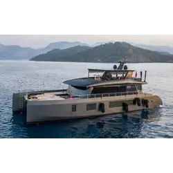
The latest series of GPSMAP devices by Garmin offers enhanced features, including improved resolution and faster processing capabilities. The multifunction display, measuring 12 inches, presents an optimized map interface that seamlessly integrates with Garmin's marine system. Notably, the display is designed to be highly visible even under direct sunlight.
The Garmin Sailassist feature provides a comprehensive range of information for sailing enthusiasts. This includes laylines, start line guidance, enhanced wind rose, heading and course-over-ground lines, true and apparent wind data, as well as controls for the tide, current, time, wind angle, drift, current, and wind speed, among others.
Users have the option to incorporate optional Bluechart sea charts, which leverage data from Garmin, Navionics, Auto Guidance technology, and other premium navigation features. These charts, available as Bluechart g3 and Bluechart g3 Vision, provide a comprehensive and detailed mapping experience.
With Garmin Marine Network, sharing information with other Garmin devices on your boat is effortless. This includes the exchange of maps, user data, radar data, and IP camera data, enhancing overall connectivity and collaboration.
The compatibility of the GPSMAP Plus with NMEA2000 and NMEA0183 standards allows for direct integration with various systems such as autopilots, digital switching, weather data, the FUSION Link audio system, media, VHF, AIS, and more. This broad compatibility ensures seamless connectivity and data exchange.
Through the ActiveCaptain app, users can connect their GPSMAP device to Wi-Fi and access the free mobile app's features. This includes the OneChart feature, which provides access to charts, Smart Notifications, software updates, Garmin Helm, Garmin Quickdraw community, and more, enhancing the overall functionality of the device.
Thanks to the integrated ANT technology, connecting external devices to the GPSMAP Plus is simple and efficient. This includes devices like Quatix marine clocks, gWind Wireless 2 transducers, GNX Wind marine instruments, and radio remote controls, providing an expanded range of compatible accessories.
The JI939 connectivity allows for easy integration of data from various engines, including Yamaha engines, enabling seamless integration of engine information into the GPSMAP Plus.
The ONEHELM function consolidates third-party options onto a single page, offering a convenient overview of available features, such as EmpireBus Digital Switching.
Furthermore, the GPSMAP Plus supports PANOPTIX, enabling users to connect their chartplotter to PANOPTIX or PANOPTIX LIVESCOPE sonar (transducers sold separately). This integration provides real-time, comprehensive visibility of the underwater and side views around the boat, enhancing situational awareness for users.
The package consists of the following items: a GPSMAP 1223 chartplotter, a preinstalled microSD card, a power cable, an NMEA 2000 T-connector, a 2-meter NMEA 2000 drop cable, a bail mount kit with knobs, a flush mount kit with a gasket, a protective cover, trim piece snap covers, and documentation.
NMEA 0183 is a combined electrical and data specification for communication between marine electronics such as echo sounder, sonars, anemometer, gyrocompass, autopilot, GPS receivers and many other types of instruments.
No reviews found