topRik experts explain why a skipper needs a handheld GPS, even if the yacht is equipped with a stationary multifunctional marine display with built-in GPS or a satellite navigation system installed. Read this article also if you want to learn about the main properties of this device, its maintenance and what you should pay attention to when choosing between various models.
The peculiarities of operating GPS navigators at sea impose specific requirements, which can only be fully met by a specially designed marine device. What are these features?
On land, a GPS receiver helps out a lot, but in addition to it, as a rule, you have some fixed landmarks such as a road or relief elements, making it easier to still stick to your route if the device breaks. In the middle of the sea, in your field of vision there are only monotonous waves from horizon to horizon.
Distant lighthouses, islands, and the coastline, if visible, often merge into a barely visible strip, which is not easy to identify, as well as to determine the distance to it even with great experience. In the eyepieces of 7x binoculars, when rocking, these objects perform an incredible dance, sometimes to the point of complete impossibility of observation. In the dark, in rain, fog or storm, your field of vision is often limited to the nearest wave crests a dozen or two meters away. And navigational hazards—reefs, shoals, rocks, other sunken ships, and so on—are also found in abundance here.
If on a hiking trip or a car trip, due to a navigation error, you will just arrive late to your destination, in the worst case, spend the night in the forest, use up fuel and get stuck on the road, etc. But at sea the error of a hundred meters can lead to the loss of your vessel, cargo, people, and other destructive consequences. Therefore, marine navigation - one of the main areas of GPS application - can only be compared in terms of responsibility with air navigation. The rules of safety, maritime practice, and navigator duty, developed by centuries of experience, are written in blood of unfortunate sailors.
Your life might literally depend on the reliability of your ship's GPS navigators and other navigation devices, their ease of use, the quality of maps, and your navigation skills. This, in addition to increased requirements for GPS navigators themselves, entails the requirement for their mandatory duplication with other navigation means. Thus, not a single ship, no matter what electronic innovations it is equipped with, can go to sea without a simple magnetic compass.
And modern technologies allow, in addition to a stationary GPS receiver built into a marine multifunctional display, to also have a handheld GPS. Most experienced sailors who make long passages use them, never leaving port without this pocket backup. In the experience of these captains, the chartplotter can fail, leaving just a compass and paper charts for guidance. It’s good if you didn’t forget how to use those, but some never learned to start with.
We are far from the idea that you don't have to learn how to navigate using old-school tools, since our experience of crossing the Atlantic convinced us that we should provide ourselves with maximum knowledge and technology in order to protect the crew and passengers. So, a portable GPS navigator is one of the most necessary devices on board a yacht, even if it is equipped with the most advanced built-in satellite navigation systems.
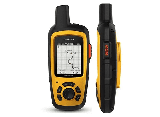
Key Features of Handheld GPS
When selecting handheld GPS navigator questions often arise about screen size, but much less often about those characteristics that really matter. Let's look at which of them you should pay attention to so that the device becomes your reliable assistant even in a difficult maritime situation.
Of course, as long as you're not in an emergency and your stationary GPS navigator is doing its job perfectly, you can even forget about its portable little brother, unless it for controlling the situation when spending the night at anchor. It is unlikely that you will be woken up in your cabin by the chartplotter signal from the helm station when the boat is torn from its anchor. But a portable device that you can take with you will cope with this task. And this is already a good enough reason to get a handheld GPS navigator.
Any sailor at any moment must be ready to fight for his life and the lives of the people who depend on him. We won’t imagine the worst, we’ll just imagine the situation that we talked about at the beginning of the article: all electronic navigation systems for navigating at sea are out of order, you need to transmit a distress signal and report your exact coordinates to rescuers.
This is where you need a handheld GPS. Based on the proposed situation, you can already determine for yourself which characteristics are the main ones for these portable devices. Certainly not the screen size.
Signal Accuracy and Reliability
GPS monitoring - a global tracking system for movement on land or water - can accurately determine the location of almost any object. Satellites in orbit (24 tracking satellites have been launched), regardless of weather conditions and terrain, can receive signals from GPS transmitters around the clock. All satellites are united into a single network with earth-based tracking devices.
Is it possible to improve the capabilities of a portable GPS receiver? Yes, if you select a model that supports the maximum number of GPS, WAAS, Beidou, Galileo, QZSS, SBAS, IRNSS and GLONASS satellite constellations for faster positioning and improved signal reliability. Of course, you won’t need all these systems together on one device unless you’re going around the world. Just select support for the systems that your yacht may be within range of.
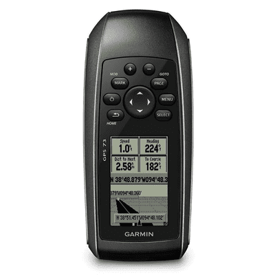
Waterproof and Shock Resistant
Any device that is used in an extreme situation must have a reinforced design and be highly impact resistant. And if we are talking about marine equipment, then it must have a high level of water resistance. IPX7 or IP67 are quite sufficient: this means that the device will remain operational when “diving” to a depth of 1 meter. Check whether the navigator is equipped with a beacon or sound signal so that you can quickly locate it if necessary or fish it out of the water.
Another important property that your future portable handheld GPS navigator should have is buoyancy. After the device dives for any reason, it must surface back. Therefore, in the characteristics of the selected model, be sure to pay attention to the mention of buoyancy.
Battery Life
So, in an unpleasant situation at sea, you got your handheld GPS navigator - it floated out without being damaged by the water and continues to transmit and receive information from satellites. But how long can it do this?
When choosing a model, pay attention to the battery life in regular use mode and in Expedition mode.
By the way, here is an argument against replacing handheld GPS with a tablet or a phone with built-in navigator. Just think of how many other programs you have there that will drain precious battery power.
Additional Features and Functionality
Most additional functions of a handheld GPS navigator in extreme conditions become simply necessary. Let's take a look at them now.
Mapping Capabilities and Device Memory
Most handheld GPS navigators from leading companies already come with pre-loaded maps. For example, Garmin, in addition to the base map of the world, Bluechart, Navionics and some other manufacturers of marine electronic charts, also offer their own cartography.
Your task when choosing a navigator is to determine whether the quality and characteristics of the cartography it supports suits you.
The device's internal memory can be expanded using a microSD™ card, providing convenient storage and access to more information.
Find out what chartplotter features you'll get and whether you'll be able to manage necessary waypoints and routes.
Built-in Sensors
A lot here depends on what information you consider important in an extreme situation at sea, and how you are going to use the handheld GPS. There are models with a built-in barometer, compass, autopilot control, as well as a fairly wide range of functions for lovers of sea fishing, in particular an echo sounder.
Built-in sensors include SOS and Man Overboard buttons. The latter function allows you to immediately record the moment and place of a person’s fall, which greatly facilitates rescue.
Compatible with Other Navigation Systems
This position should also be checked, if only because some manufacturers offer models that are compatible with navigation systems only made by them. But in general, handheld GPS navigator can “cooperate” with AIS, radar, sonar.
Efficient communication with compatible devices is typically achieved through seamless wireless connectivity via Bluetooth® and ANT+® technologies. By the way, you can receive emails, SMS and alerts through this network.
Interface and Ease of Use
Despite the fact that this section is the last in listing the important functions, usability is also very important.
Screen Size and Readability in Sunlight
Of course, the brightness of the image on the screen and its clarity in any weather - both in the sun and in twilight or darkness - are much more important than its size. Let’s also not forget that keeping a large screen running requires more battery power. But experience shows that a 2-3-inch diagonal screen is quite comfortable for viewing, of course, with good resolution and a liquid crystal matrix.
Ease of Management and Configuration
Situations at sea do not always allow you to tinker with the settings for a long time and master the controls. Therefore handheld GPS navigators have an intuitive interface that simplifies management and settings.
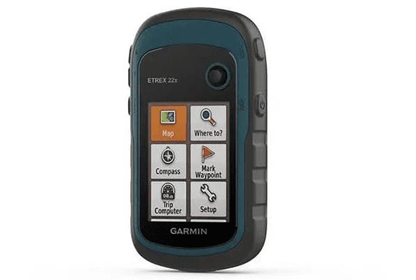
A liquid crystal screen instead of a touchscreen and several large buttons throughout the body - that’s all the controls you want.
Availability of Backlight for Night Use
Such a function must be present in the device, regardless of where you plan to use it.
Tips for Care and Maintenance
Like any electronic device, handheld GPS requires regular maintenance, dust cleaning and repairs, as well as software updates.
Common Problems and Their Solutions
Navigator malfunctions can be:
- Software-related (software failure) - the navigator does not turn on, hangs on the splash screen, some menu items not working, freezes when trying to activate any menu item, constant reboots, settings not saved, etc. In this case, "reflashing" helps - a complete replacement of the navigator software. As a rule, the functionality of the device is completely restored after this.
- Mechanical in nature - the screen is cracked, the charging connector is damaged, the power button has fallen off, etc. In this case, just replacing the faulty part helps – these products are made to be sturdy.
- Moisture “smears” visible on the screen, traces of corrosion visible on the board, the navigator drains the battery too quickly, the sensor is visually intact, but does not work. In some cases, cleaning the circuits with special cleaning liquids, soldering oxidized areas, and replacing faulty parts helps. Results are not guaranteed.
- If operating conditions are violated (temperature conditions, use of incompatible charging, etc.), eliminating the defects usually depends on correct diagnostics and repair (better turn to a repair shop unless you know what you are doing).
FAQ
Can a handheld GPS be used for a yacht/boat in extreme weather conditions?
This is one of the purposes of handheld GPS navigators. The experience of the topRik team proves that this device is indispensable in extreme marine conditions. None of us go to sea without it now.
What features should a handheld GPS have for fishing?
It should have a built-in echo sounder and the ability to mark fish concentration areas along the route.
How important is waterproofing for a marine GPS?
This is one of the most important elements of its protection, especially when it comes to using the device in extreme marine conditions – IP7 or IP67 waterproofing standards are more than enough for most cases.
How much does a good handheld GPS for yachting cost?
topRik marketplace offers high-quality models from leading manufacturers of marine equipment, including handheld GPS navigators, starting from 125 euros.
How to update maps and software on GPS?
Here you should know that the cartography of one handheld manufacturer GPS navigators is not necessarily supported by others, as is the case with NAVITEL and Garmin maps. Each manufacturer's software includes a mapping management program. Just take advantage of its capabilities – there are instructions provided on official website with specific actions described in detail, as well as video tutorials on every popular product regarding software installation and updates.

