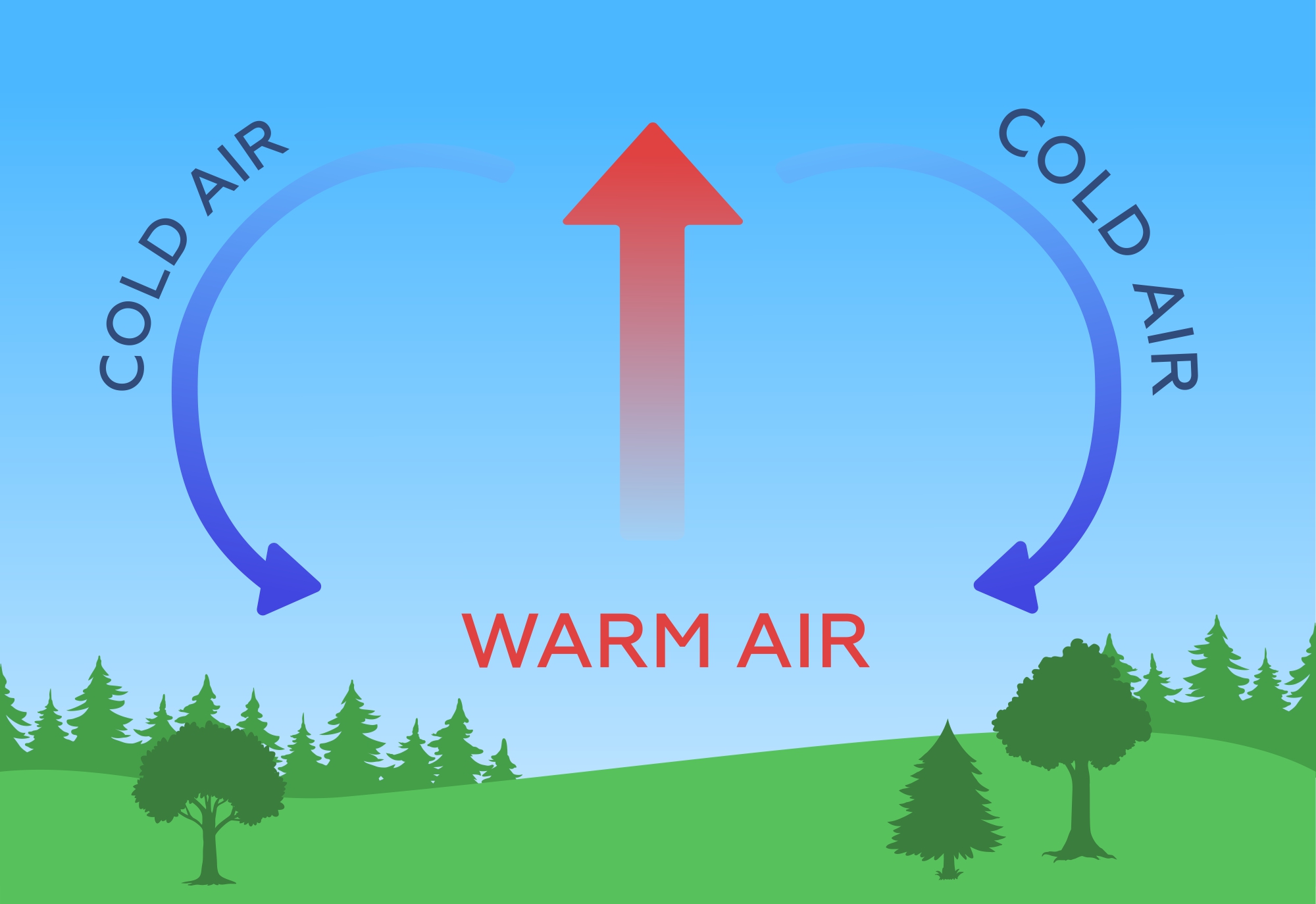
Convection
The rise of warm, less dense air surrounded by denser, colder air. Technically, air density also depends on humidity, and contrary to widespread misconception, air density decreases as humidity increases, not increases.
Water in the atmosphere
The transition of water from one aggregate state to another is accompanied by absorption or release of heat. During evaporation of water (the process of transition from the fluid state to the gaseous state), heat is absorbed, which is then released in the form of the latent heat of evaporation during the reverse process, condensation. Condensation occurs when the air temperature drops to the so-called dew point, when the water vapor it contains reaches 100% humidity.

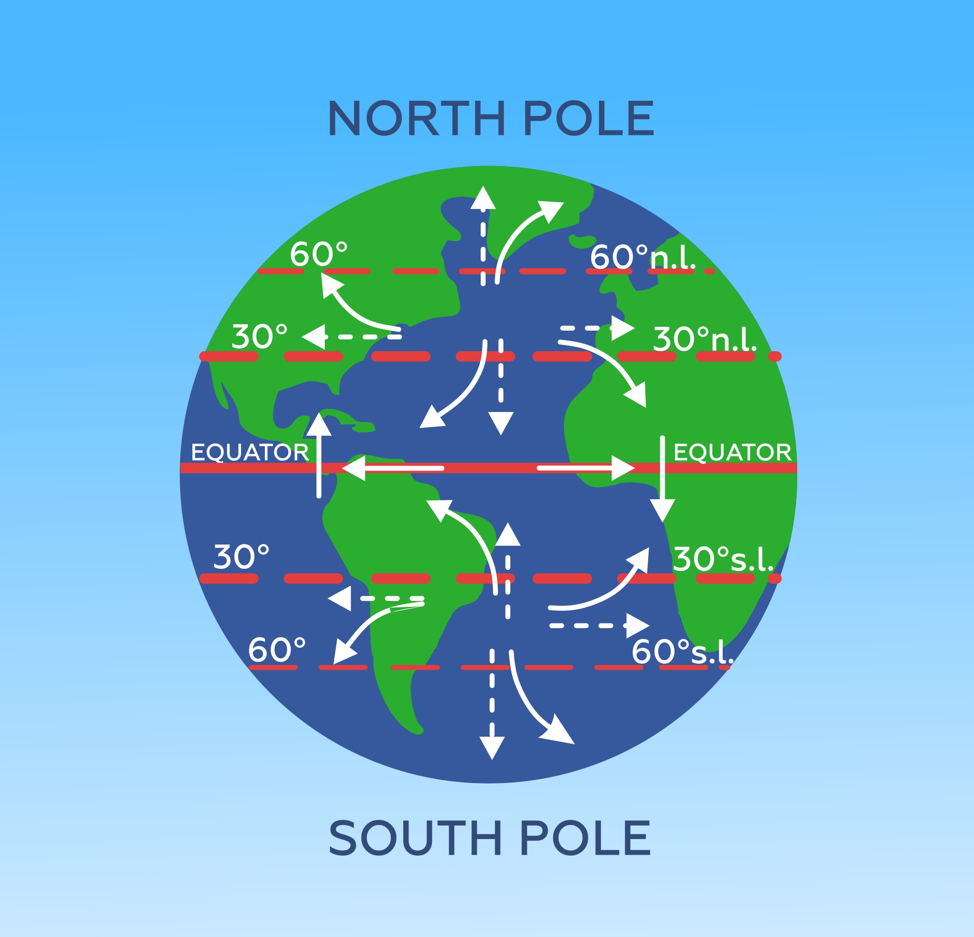
Coriolis force
One of the most mysterious forces associated with the fact that we live on the surface of a rotating Earth, which makes its own adjustments to the balance of available forces. The Coriolis force affects any body moving relatively to the Earth, including the air mass, deflecting it to the right in the northern hemisphere (to the left in the southern hemisphere) in proportion to the speed of its movement. Moreover, if at the equator the Coriolis force is equal to zero, then at the poles it is maximal.
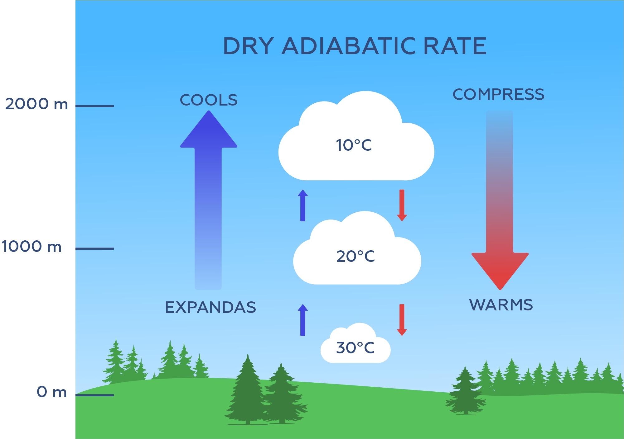
Adiabatic process
When the volume of air decreases as the pressure increases, its temperature also increases. Conversely, when pressure drops and volume increases, the temperature goes down. Therefore, the air is cooled when it rises, and it is heated when it falls.
That's it!))
As you can see, there is nothing complicated yet! And all our further reasoning will be based only on these four points!
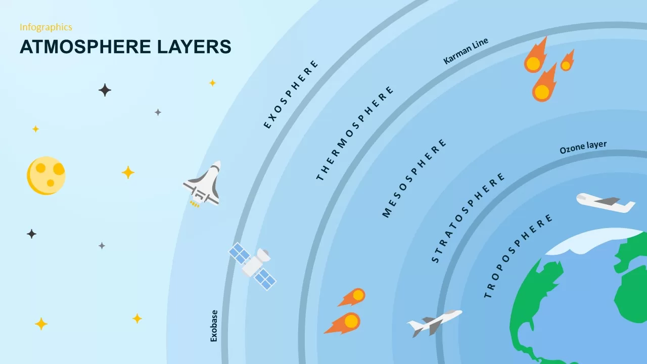
Vertical structure, Stratification of the atmosphere
From an ordinary point of view, the air that surrounds us is perceived as an ephemeral, almost weightless substance, completely homogeneous and well-mixed. In fact, atmospheric air is far from being homogeneous and has a certain internal structure.
In the passenger cabin, we hear the pilot say: "We are at an altitude of ten thousand meters and the temperature outside is -50 °C". Or when we climb mountains, we also feel this drop of temperature, that is, even our personal experience tells us that the air temperature changes with altitude. The change in air temperature with altitude indicates the vertical structure of the atmosphere. It should be remembered that the temperature drop with altitude is not absolutely obligatory, it is just observed more often.
Lets take a closer look at the vertical structure of the atmosphere, in meteorology it is called stratification, and the effect it has on the processes of vertical air movement.
At first, the fact that the Earth's surface has warmer air seems rather surprising. It would seem that air, having a much higher temperature, should "pop up" or rise up, in accordance with the law of convection, while cold air from higher altitudes should descend and accumulate near the surface. But then, why the drop in temperature with altitude is the standard and most commonly observed stratification of the atmosphere?
And this happens because air is a sphymatic medium, and the air mass located near the surface of the Earth experiences the pressure of the entire overlying column of the atmosphere. At the same time, the volume of air located at a higher altitude is under less pressure because the height of the atmospheric air column above it decreases. If we go back to the example of flying on passenger planes, we always feel this change in pressure when we experience a slight pain and tinnitus when we gain altitude after takeoff or when we descend before landing. But as the pressure decreases, according to the laws of gas physics, air must expand, and its density, in turn, must decrease. And this effect of pressure drop on air density decrease is much greater than the effect of temperature drop on density increase. That's why the density of warm air near the ground is much higher than the density of cold air above. Then there is no reason for the warm, but denser air to "pop up" or rise to higher altitudes, where the cold, but less dense air is. Thus, "everything keeps in its place".
But let's imagine, however, that the near-surface warm air rises upward for some reason. As it rises due to a decrease in pressure, it begins to expand, and this, in turn, will cause its temperature to decrease in accordance with the adiabatic law. The air temperature is considered to drop by 1 °C for every 100 m of ascent.
The ratio of this changed temperature of the ascending air to the temperature of the ambient air at altitude will be the main factor determining the further course of the ascending air. In fact, the values of the densities of our initial near-surface air and the surrounding air, which are now at the same height and, accordingly, at the same pressure, will now be completely determined by the values of their temperatures. For the first, it is the temperature that it acquired due to adiabatic expansion (its initial temperature minus 1 °C for every 100 m of ascent), and for the second, the temperature due to its available vertical distribution, i.e. stratification.
If the change in ambient air temperature with altitude is less than 1 °C per 100 m, the elevated air will be colder than the ambient air and, therefore, denser. And then, in full accordance with the convection law, it will begin to "sink" in the surrounding air and will return to its original level. In meteorology, such a change in temperature with altitude is called stable air. And any vertical movement of air masses will be suppressed under these conditions.
The case of stable stratification includes isothermia. It is a vertical distribution in which the temperature remains constant with altitude. Of course, a stable stratification also occurs in an air mass where the temperature rises with altitude, since in this case the air at altitude is much warmer than the air lifted from the surface. The corresponding vertical temperature distribution is called an inversion. In the latter case, there is practically no vertical mixing of air in the atmosphere.

Occasionally, there are such conditions in the atmosphere, that the vertical distribution of atmospheric air temperature is characterized by a temperature drop with height of more than 1 degree Celsius per 100 m. In this case, the volume of air lifted from the surface will be warmer than its surroundings, then it will immediately, according to the law of convection, flow further upwards. Atmospheric stratification with such vertical temperature distribution is called unstable air, and such stratification is the most favorable for the development of vertical dynamic processes in the atmosphere and intensive vertical mixing.
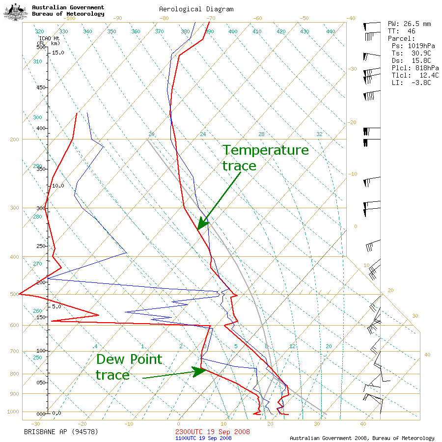
Of course, in order to make an informed judgment about the type of atmospheric stratification it is necessary to have a diagram of air temperature distribution with altitude, which is the most important part of the so-called Skew-T Diagram. These diagrams are made on the basis of data obtained from meteorological probes and characterize the vertical distribution of air temperature and humidity, as well as wind speed and direction at different altitudes. The probes are launched at special aerological stations, the number of which is much smaller than that of standard weather stations. Therefore, if you are near a major city or airport.
To understand the importance of vertical stratification for wind dynamics, it is sufficient to limit ourselves to the simplest cases. We consider stratification in the near-surface layer to be stable when an inversion layer is located near the surface, i.e., the underlying surface has a temperature lower than the temperature of the overlying air. Stratification can be considered unstable if the surface temperature is significantly higher than the temperature of the air above it. With this simplified consideration, knowing the air temperature above the water surface and the water temperature at the surface will be sufficient to estimate stratification above the water surface. If the former is higher, the stratification in the driving atmospheric layer is stable. If the air temperature is lower than the water temperature, then the stratification will be unstable.
Usually stable stratification in the drive layer is observed in spring and early summer. At this time, the water has not yet had time to warm up after the cold season, and the air, especially moving from the coast, is already sufficiently warm. The same is observed after the passage of a warm front, when the relatively warm air mass appears over the colder underlying surface. The latter occurs both over water and over land.
In autumn and early winter, an inverse, unstable stratification is formed over water areas: water still retains the accumulated heat, while the air is already cold. A similar situation occurs when a cold front passes: the cold air moving behind it finds itself above the underlying surface of water or land that still retains heat.
It is important to be able to estimate stability in the lower atmosphere by indirect signs. Since in stable stratification vertical mixing is weakened, cloudiness has a layered character, a layer of air with limited visibility (gloom, dense haze) lies at the surface, the wind is weak and relatively smooth. When unstable, when conditions for vertical mixing are created, air is clear and transparent, clouds are of cumulonimbus shape, wind is characterized by high speeds and gustiness.
But, whether our air is stable or unstable, vertical movements will not start without some external impact, vertical movement of air from its initial height, which was discussed in the beginning of the section for the case of air rising from the surface. What can serve as such a push?
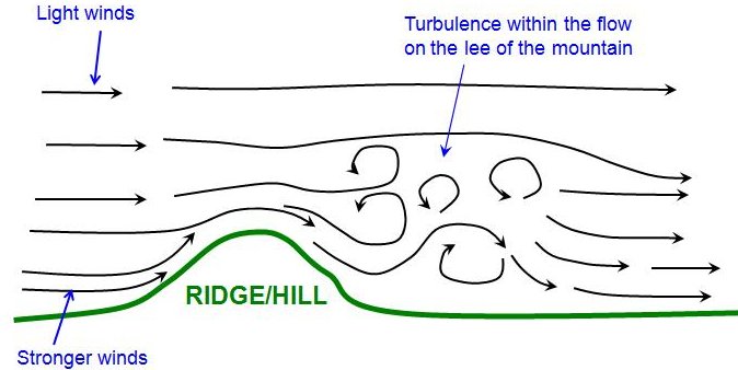
First, it is relief. When the air flow collides with a slope on its way, a vertical component appears in its movement, which can serve as such a mechanical push to disrupt the vertical balance.
Second, there are dynamic causes: the phenomena of convergence and divergence. The first is when horizontal air movements tend to converge, which pushes the air upward. The second, divergence, is when, on the contrary, there is a divergence of flows, which leads to a compensatory lowering of air from the upper layers.
Finally, the third reason is mechanical turbulence, which in case of stable stratification is suppressed, and in case of unstable stratification turns into convective mixing.

Smoke from chimney as indicators of stability
- stratification is stable and inversion in the surface layer is possible;
- stratification is unstable, vertical mixing is present;
- stratification is strongly unstable, active formation of thermics.