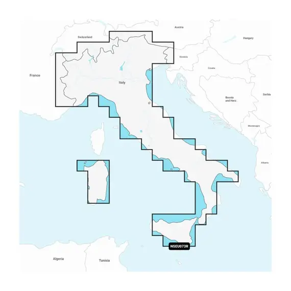
Garmin Navionics+ - NSEU073R - Italy, Lakes & Rivers Charts

The price provided is NET-price, meaning shipment and VAT are not included. Additional duties and tax payments might be required. Taxes and delivery costs are calculated after ordering the goods and depend on the type of client and delivery address.
Access comprehensive mapping of coastal features, lakes, rivers, and other geographical elements. The integration of Garmin and Navionics content ensures global coverage for boaters.
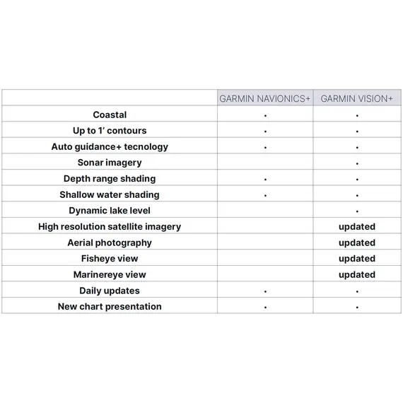
The charts undergo continuous enhancement, with as many as 5,000 updates implemented daily. With the one-year subscription included, you can conveniently access daily chart updates through the ActiveCaptain app.
By leveraging the sophisticated routing functionalities of Garmin and Navionics, the integrated Auto Guidance+ technology provides you with recommended routes from one dock to another, encompassing various navigational features like channels, inlets, marina entrances, and other relevant points.
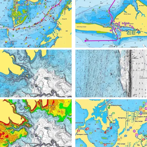
Benefit from high-resolution depth range shading, offering a selection of up to 10 color-shaded options. Instantly identify your desired target depths with ease.
For enhanced fishing and navigation experiences, a detailed bottom structure is depicted through up to 1' contours. This provides improved fishing charts and heightened detail in areas like swamps, canals, harbors, marinas, and beyond.
A user-defined depth shading feature enables clear identification of shallow waters to avoid any navigational hazards.
Leverage community-sourced content for invaluable points of interest (POIs) including marinas, anchorages, hazards, businesses, and more. Gain recommendations from experienced boaters with first-hand knowledge of the local environment.
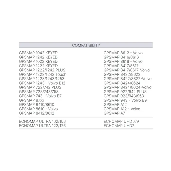
Please, check detailed feature compatibility for your chartplotter.
No reviews found


