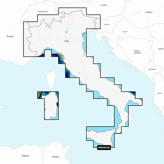
Platinum+ Italy, Lakes and Rivers Charts

The price provided is NET-price, meaning shipment and VAT are not included. Additional duties and tax payments might be required. Taxes and delivery costs are calculated after ordering the goods and depend on the type of client and delivery address.
Navionics Platinum+™ charts offer an extensive range of features, combining the complete content of Navionics®+ cartography with integrated offshore and inland mapping. These charts include data from various official, government, and private sources, presented in a familiar and user-friendly interface.
The innovative 1' (0.5 m) bathymetry charts are a standout feature, incorporating sonar data contributed by the boating community. With up to 5,000 daily updates, users can access the most accurate and current information available, ensuring reliable navigation.
Furthermore, end-users gain access to a complimentary annual subscription of daily updates and enhanced functionalities, incorporated within every Navionics+ cartographic solution. After the initial year, renewal at a discounted price is possible.
With Relief Shading, bottom structures become clearer, while Satellite Imagery provides top-down views of coastal and inland areas. The 3D perspective view enhances awareness by highlighting key features, and Aerial Photos provide a better sense of surroundings.
Further advantages include the ability to receive local knowledge from Navionics Boating app users, as well as seamless data transfer between compatible chartplotters and the app.
Worldwide map coverage options cater to various navigation preferences, ranging from large coverage areas to more localized chart cuts. Before proceeding, it's essential to check the compatibility of Platinum+ content and features with your GPS chartplotter.
No reviews found


