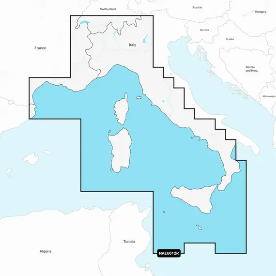
Navionics+ Tyrrhenian Sea and Central Mediterranean Charts

The price provided is NET-price, meaning shipment and VAT are not included. Additional duties and tax payments might be required. Taxes and delivery costs are calculated after ordering the goods and depend on the type of client and delivery address.
Navionics+ offers comprehensive offshore and inland marine mapping, encompassing rivers, bays, and over 42,000 lakes globally. This all-in-one solution ensures clear and dependable cartography compatible with various chartplotter brands.
Upon purchasing any Navionics+ mapping solution, you receive a one-year subscription, which includes daily updates and advanced features. After one year, renewal is available at a discounted rate.
The charts are compiled from multiple official, government, and private sources, and presented in a familiar format.
Utilizing innovative proprietary systems, Navionics creates 1' (0.5 m) bathymetry charts that incorporate sonar data shared by the boating community.
Benefit from local insights contributed by users of the Navionics Boating app on your smart device.
With up to 5,000 daily chart updates, you access the most precise and up-to-date information.
Enjoy features like suggested dock-to-dock routes, customizable views, seamless transfer between compatible chartplotters and the Navionics Boating app, and real-time HD depth map updates while on the water.
Navionics+ provides worldwide map coverage with integrated content, allowing you to select desired navigation features and map regions.
Note: Ensure compatibility with your GPS chartplotter before use.
No reviews found


